BLM Program Support

Find BLM science-related tools, guidance, data, research, assessments, and other information that support all BLM program areas at state, field, and national levels.  

  • Abandoned Mine Lands

    ** Under Construction **

    BLM Abandoned Mine Lands

    An abandoned hardrock mine on or affecting public lands administered by the BLM, at which exploration, development, mining, reclamation, maintenance, and inspection of facilities and equipment, and other operations ceased as of January 1, 1981 (the effective date of the BLM’s Surface Management regulations codified at 43 CFR 3809) with no evidence demonstrating that the miner intends to resume mining. For many abandoned mines, no current claimant of record or viable potentially responsible party exists. Abandoned mines generally include a range of mining impacts, or features that may pose a threat to water quality, public safety, and/or the environment.

    Abandoned Mine Land (AML) Program

    The BLM’s program focuses on reclaiming hardrock abandoned mine lands on or affecting public lands administered by the BLM. The primary goal of the program is to remediate and reduce actual or potential threats that pose physical safety risks and environmental degradation. The BLM applies risk-based criteria and uses the watershed approach to establish project priorities. The program also works to return mine-impacted lands to productive use(s).

  • AIM-Assessment, Inventory, and Monitoring

    The objective of the Assessment, Inventory, and Monitoring (AIM) Strategy is to provide a standardized approach for measuring natural resource condition and trend on Bureau of Land Management (BLM) public lands. The AIM Strategy provides quantitative data and tools to guide and justify policy actions, land uses, and adaptive management decisions.

    AIM is:

    •Structured implementation to guide monitoring program development, implementation, and management decisions.

    •Standardized field methods to allow data comparisons throughout the BLM and in collaboration with BLM partners.

    •Appropriate sample designs to minimize bias and maximize what can be learned from collected data.

    •Data management and stewardship to ensure data quality, accessibility, and use.

    •Integration with remote sensing to optimize sampling and calibrate continuous map products.

    •Evidence-based decisions using standard workflows

  • Air

    ** Under Construction **

    NOTE: Materials available from these pages are contributed by BLM staff. The collections are being developed and may be an incomplete baseline of relevant content. It is expected that each collection will continue growing in time to reflect the most current information available. 

  • Aquatic Resources

    Riparian and wetland areas, lakes, streams, and aquifers on public lands managed by the Bureau of Land Management (BLM) are among the most important, productive, and diverse resources in the Nation, providing sustained value to the American public. They provide habitat for myriad species of plants, fish, and wildlife; provide ecosystem services such as drinking water, pollination, and nutrient cycling; attenuate effects of wildfires, floods, and drought; and are key to the vitality of local economies and communities.

    Aquatic resources also support permitted activities on public lands such as livestock grazing, energy and mineral development, timber production, and countless recreation opportunities. The BLM's Aquatic Resources Program works with BLM managers, tribal, federal, state and local governments and non-governmental partners to ensure the long-term sustainability of aquatic resources for the use and enjoyment of present and future generations.

    NOTE: Materials available from these pages are contributed by BLM staff. Expect the collection to continue growing in time to reflect the most current information available. 

  • Cadastral Survey

    NOTE: Materials available from these pages are contributed by BLM staff. The collections are being developed and may be an incomplete baseline of relevant content. It is expected that each collection will continue growing in time to reflect the most current information available. 

  • Crowdsourcing and Citizen Science (Participatory Science)

    Management decisions supported by sound, current science are essential to efforts to manage lands for multiple use and sustained yield in challenging and changing conditions. Citizen science and crowdsourced data programs help foster meaningful connections between people and their public lands, expand understanding of the BLM's multiple-use mission and the use of science in accomplishing this mission, and inspire conservation stewardship and service.

  • Cultural Resources

    ** Under Construction **

    Cultural resources on public land are the physical remnants of our collective past.  Resources like iconic landscapes, archaeological sites, and historic structures hold unmatched inspirational, spiritual, and scientific importance for tribes, public land users, researchers, and others.  BLM’s cultural heritage program accounts for the scientific, historical, ecological, environmental, and archeological values of these resources to manage, protect, develop, and enhance use for present and future generations.  

    NOTE: Materials available from these pages are contributed by BLM staff. Expect the collection to continue growing in time to reflect the most current information available. 

  • Drought & Water Availability

    Submitting New Information to the Drought Page:

    BLM offices can contribute to the drought-related information on the SPP by clicking on the “Submit New Material” text at the top of the drought page and completing the webform. The NDT will be responsible for quality control of the uploaded material and updating the official information displayed on the SPP including policy, scientific literature, BLM publications, other media, the table providing drought severity assessments and a table for drought tools and data.

  • Environmental Change

    Environmental change – warming temperatures and accompanying changes in precipitation and weather patterns – will play a significant role in shaping BLM’s stewardship over the coming decades. It significantly impacts the health and resilience of ecosystems, exacerbating existing management challenges and threatening the sustainability of current land uses, including energy production, livestock grazing, recreation, and timber harvest.

    BLM managed lands are experiencing warming temperatures, altered water availability, and changes in vegetation composition, which in turn affect wildlife, livestock, recreation, and cultural values. Environmental change creates new risks and exacerbates existing vulnerabilities in communities across the United States, presenting growing challenges to human health and safety, quality of life, and the rate of economic growth. Without substantial and sustained reductions in global greenhouse gas emissions, transformative impacts on some ecosystems will occur. To address these complex challenges, the BLM must rely on solid science, strong partnerships, and adaptive management practices.

    Explore this page for curated science products relevant for land managers, including adaptation menus, environmental change assessments, and forward-looking environmental change datasets.

  • Fire and Aviation

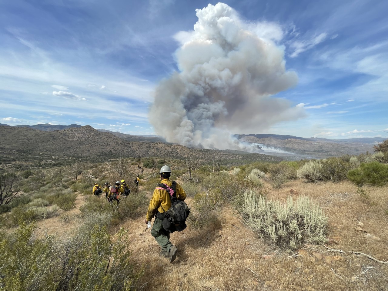
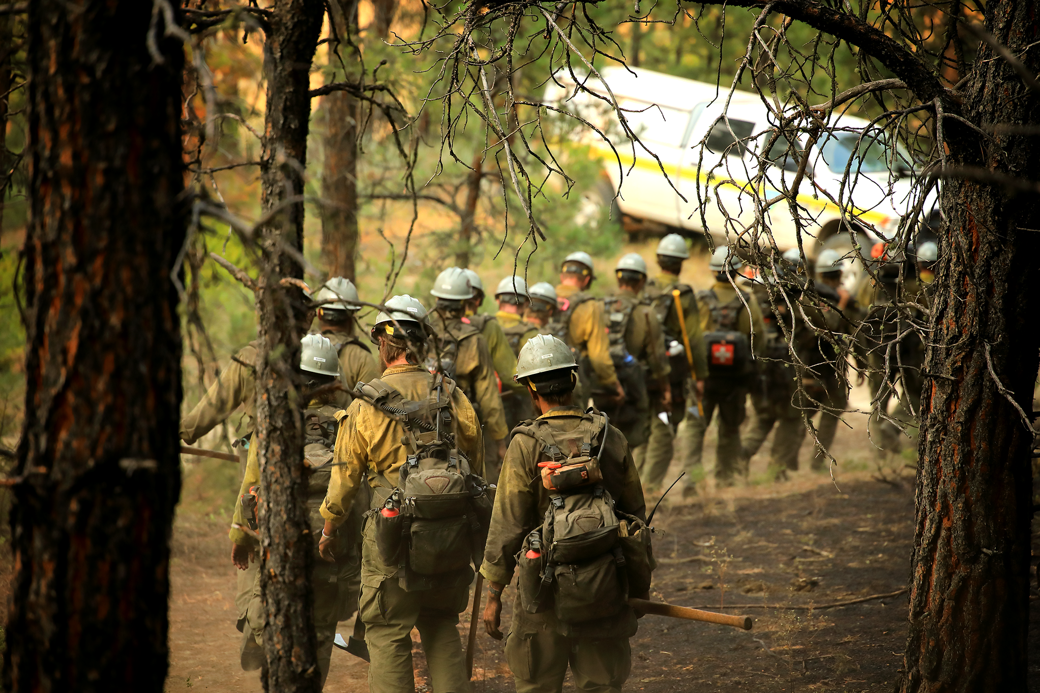
    Wildland firefighters construct fireline on the 2022 Dodge Springs Fire in Ely, Nevada. Photo by Alyssa Engdahl, BLMThe Three Rivers fire burned actively at night. Photo by Steven Bunt, USFSWOLF CREEK, NV - AUGUST 24: A powerful monsoon storm produces cloud-to-ground lightning Monday, Aug. 24, 2017, in Wolf Creek. (Marc Sanchez/BLM)A line of wildland firefighters walks through a scorched forest. Photo by Austin Catlin, BLM.

    The Fire and Aviation Directorate (FAD) provides leadership and direction to a wide range of program areas, which include Fire Operations, Fire Aviation, Fuels Management/Fire Planning, Fire Safety, Fire Training, and Equal Employment Opportunity/Human Resources.  Collectively, these programs contribute to safe and efficient wildland fire management, rehabilitation of burned landscapes, implementation of Secretarial and Presidential priorities, and participating in integrated vegetation management practices with other Bureau Divisions.  Outcomes of the work accomplished by the FAD include improved wildland fire management effectiveness, cross-boundary planning with partners, continuation of resilient landscapes, reduction in hazardous fuel conditions, and implementation of the National Cohesive Wildland Fire Management Strategy.

    NOTE: Materials available from these pages are contributed by BLM staff. The collections are being developed and may be an incomplete baseline of relevant content. It is expected that each collection will continue growing in time to reflect the most current information available.


  • Forestry

    NOTE: Materials available from these pages are contributed by BLM staff. The collections are being developed and may be an incomplete baseline of relevant content. It is expected that each collection will continue growing in time to reflect the most current information available. 

  • Habitat Assessment Framework

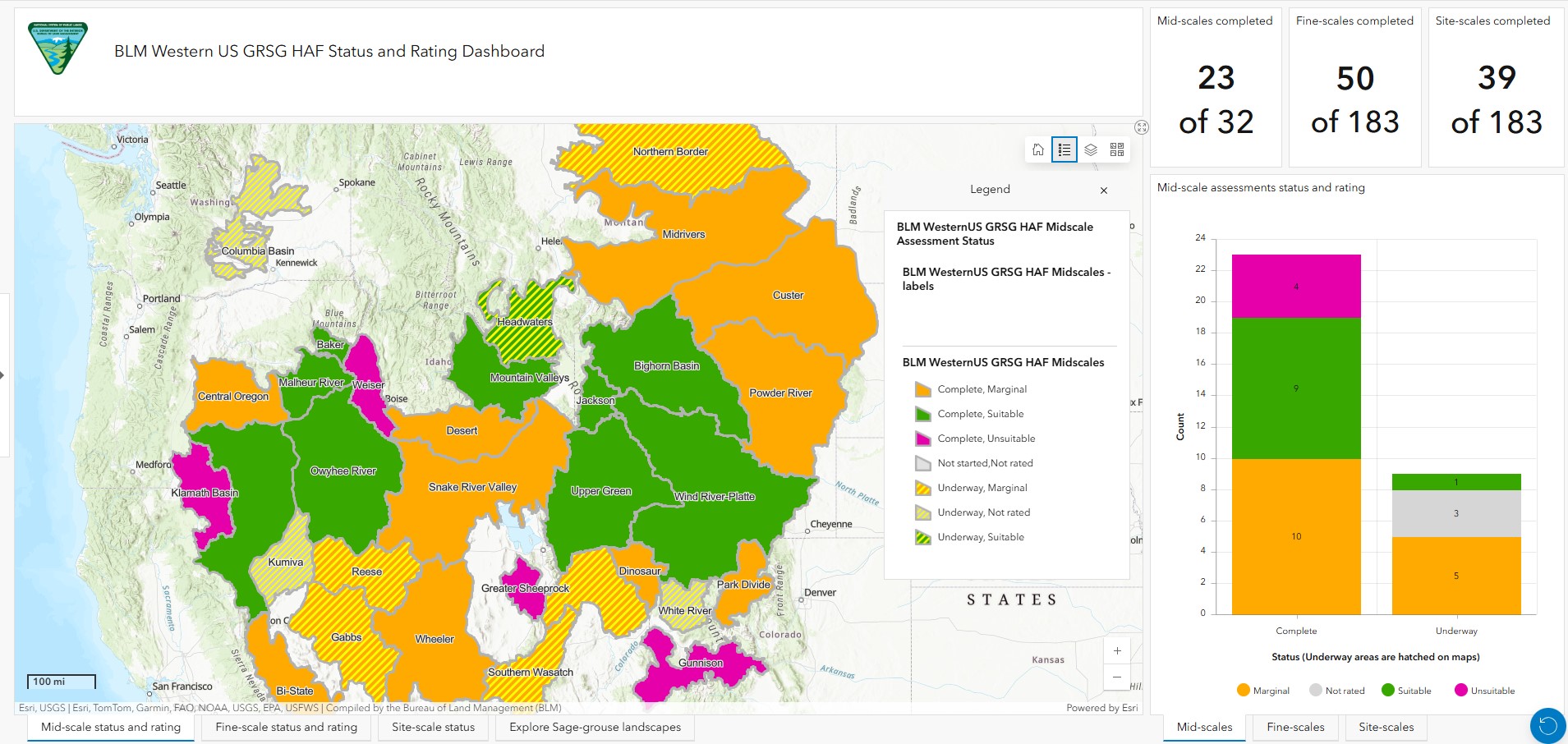
    The BLM Sage-grouse HAF Dashboard presents maps and summaries of current mid-, fine-, and site-scale assessment status range-wide.  Use the Dashboard to check on the current status of an assessment area or determine where an assessment should be made. Click on the left-side bar to obtain help on using the Dashboard.


    Image removed.


    Click here for HAF Implementation Resources

    Sage-Grouse Habitat Assessment Framework (HAF) TR6710, 2015

    The “Sage-Grouse Habitat Assessment Framework” (HAF) was conceived by several managers in the early 2000s. They assembled a diverse group of habitat specialists and sage-grouse experts from state, federal, and nongovernmental organizations to develop this habitat evaluation tool. In 2006, the “Greater Sage-Grouse Comprehensive Conservation Strategy,” published by the Western Association of Fish and Wildlife Agencies, highlighted the development and implementation of the HAF. That strategy outlined a number of objectives for the HAF, which included a temporal and spatial method for evaluating sagebrush habitats for sage-grouse suitability at multiple and hierarchical landscape scales. The HAF TR 6710 provides a blueprint for landscape conservation; success will be achieved through implementation with local stakeholder involvement. The HAF is a cornerstone of the habitat monitoring component of the sage-grouse conservation strategy.

    Gunnison and Greater Sage-grouse (including the Bi-State Distinct Population Segment) Habitat Assessment Policy IM-2022-056

    Greater Sage-grouse RMPA revisions – Applicable Instruction Memoranda

    BLM Library  Greater Sage-grouse Subject Guide

    Contact Us

  • Hazardous Materials Management

    BLM handles a broad range of items that meet the definition of hazardous materials. Items used in day-to-day operations such as solvents, cleaning solutions, paints, pesticides, herbicides, compressed gases, batteries and battery electrolytes, fuels and lubricants, and wood preservatives are typically hazardous materials and may become hazardous wastes when disposal is considered.

    As part of its stewardship of public lands, the BLM is also responsible for managing hazardous material releases from chemical spills; abandoned mine sites; illegal trespass/dump sites; wire burn sites for metal recovery; abandoned vehicles; abandoned facilities that used, stored, or disposed of hazardous materials; former military areas; oil and gas production sites; and other potential hazardous sites with hazardous materials. There is the potential to find hazardous materials at any location on BLM lands.

    The HMM program manages hazardous materials in accordance with the Federal Land Policy and Management Act (FLPMA) and the requirements of other Federal statutes, primarily the Clean Water Act, Comprehensive Environmental Response, Compensation, Liability Act; Resource Conservation and Recovery Act (RCRA); and Occupational Health and Safety Act. This list is not a comprehensive list as sections of other statutes (such as the Clean Air Act and Toxic Substances Control Act) apply as well. State and tribal requirements must also be included within the HMM program.

  • Land Health

    NOTE: Materials available from these pages are contributed by BLM staff. The collections are being developed and may be an incomplete baseline of relevant content. It is expected that each collection will continue growing in time to reflect the most current information available. 

  • Landscape Approach

    Landscape Approach

    NOTE: Materials available from these pages are contributed by BLM staff. Expect the collection to  continue growing in time to reflect the most current information available. 

  • Museum Collections

    ** Under Construction **

    BLM manages more than 12 million artifacts and specimens recovered from significant cultural and paleontological sites and localities on public lands. These museum collections are generated from research projects and regulatory compliance work for proposed land-use activities and are managed in three BLM curation centers and 170 non-BLM museums and university repositories. BLM’s museum program ensures that these important artifacts and specimens are prepared for long-term care and preservation in a manner consistent with Departmental and BLM policy and professional museum standards and practices, and encourages research, education, and other uses of these collections for present and future generations. 

    NOTE: Materials available from these pages are contributed by BLM staff. Expect the collection to continue growing in time to reflect the most current information available. 

  • National Landscape Conservation System

    The Bureau of Land Management’s (BLM) mission for the National Landscape Conservation System (NLCS, also referred to as National Conservation Lands) is to conserve, protect, and restore nationally significant landscapes and places that have outstanding cultural, ecological, and scientific values for the benefit of current and future generations. As defined by the Omnibus Public Land Management Act of 2009, the NLCS includes the following areas administered by the BLM:

    • National Monuments
    • National Conservation Areas
    • Components of the National Wilderness Preservation System
    • Wilderness Study Areas
    • Components of the National Wild and Scenic Rivers System
    • National Scenic Trails or National Historic Trails Designated as Components of the National Trails System
    • Any area designated by Congress to be administered for conservation purposes

    NOTE: Materials available from these pages are contributed by BLM staff. Expect the collection to continue growing in time to reflect the most current information available. 

  • National Monuments & National Conservation Areas

    ** Under Construction **

    Components of the BLM’s National Landscape Conservation System (NLCS) and that have been designated by Congress or the President as National Monuments, National Conservation Areas, and similar designations
    (collectively “Monuments and NCAs” or “components”). Similar designations include Yaquina Head Outstanding Natural Area, Piedras Blancas Historic Light Station Outstanding Natural Area, Jupiter Inlet Lighthouse Outstanding Natural Area, Headwaters Forest Reserve, Steens Mountain Cooperative Management and Protection Area, and other areas established by Congress in the future pursuant to the Omnibus Public Land
    Management Act of 2009 (OPLMA) (16 U.S.C. 7202), Section 2002(b)(2)(E). According to OPLMA, the NLCS was established in order to “conserve, protect, and restore nationally significant landscapes that have outstanding cultural, ecological, and scientific values for the benefit of current and future generations.” National program policies that are generally applicable to BLM public lands apply to NLCS components to the extent that they are consistent with the designating proclamation
    or legislation, other applicable law, and BLM policy.

    NOTE: Materials available from these pages are contributed by BLM staff. The collections are being developed and may be an incomplete baseline of relevant content. It is expected that each collection will continue growing in time to reflect the most current information available. 

  • National Scenic and Historic Trails

    ** Under Construction **

    The mission of the BLM National Scenic and Historic Trails Program is to connect people to the land and its scenic wonders, our heritage, our cultures, and our communities. Through partnerships, community involvement, citizen action and agency commitment, the BLM will administer and manage the diverse network of Congressionally designated trails and associated landscapes. In order to provide for enriching and inspiring experiences, the BLM, in fulfilling our multiple-use mandate, will protect and sustain trail resources while fostering visitor enjoyment, appreciation, and learning opportunities

    NOTE: Materials available from these pages are contributed by BLM staff. The collections are being developed and may be an incomplete baseline of relevant content. It is expected that each collection will continue growing in time to reflect the most current information available. 

  • Natural Resource Damage Assessment and Restoration

    ** Under Construction **

  • NCL

    National Conservation Lands

    NOTE: Materials available from these pages are contributed by BLM staff. The collections are being developed and may be an incomplete baseline of relevant content. It is expected that each collection will continue growing in time to reflect the most current information available. 

  • NRST

    National Riparian Service Team (NRST)

  • NSHT

    National Scenic and Historic Trails (NSHT)

    NOTE: Materials available from these pages are contributed by BLM staff. The collections are being developed and may be an incomplete baseline of relevant content. It is expected that each collection will continue growing in time to reflect the most current information available. 

  • Ntl Monuments & NCA

    NOTE: Materials available from these pages are contributed by BLM staff. The collections are being developed and may be an incomplete baseline of relevant content. It is expected that each collection will continue growing in time to reflect the most current information available. 

  • Oil & Gas

    Oil and Gas include geothermal resources and helium.

    NOTE: Materials available from these pages are contributed by BLM staff. The collections are being developed and may be an incomplete baseline of relevant content. It is expected that each collection will continue growing in time to reflect the most current information available. 

  • Paleontology

    ** Under Construction **

    Fossils on public lands preserve important information about the history of life on Earth, including climate and ecosystem diversity.  Therefore:

    1. The bureau will preserve paleontological resources for the benefit of current and future generations;
    2. The scientific importance of paleontological resources will be considered in all resource management and land use decisions;
    3. Insightful research into paleontological resources on public lands will be encouraged and facilitated; and –
    4. Programs to increase the public’s awareness and appreciation of paleontological resources will be offered.

    NOTE: Materials available from these pages are contributed by BLM staff. The collections are being developed and may be an incomplete baseline of relevant content. It is expected that each collection will continue growing in time to reflect the most current information available. 

  • Planning & NEPA

    NOTE: Materials available from these pages are contributed by BLM staff. The collections are being developed and may be an incomplete baseline of relevant content. It is expected that each collection will continue growing in time to reflect the most current information available. 

  • Plant Conservation and Restoration

    Image removed.Image removed.Image removed.

    Native plants are the green infrastructure we rely on for healthy, resilient, and biodiverse ecosystems. As wildfires and other climate-driven disasters continue to devastate the U.S., the BLM Plant Conservation & Restoration Program is working to conserve and restore the native plant communities that define America's iconic landscapes and provide wildlife habitat, ecosystem services, and recreational opportunities for all Americans to enjoy. The BLM Plant Conservation & Restoration Program is responsible for:

    • Increasing BLM access to locally adapted native seed by implementing the native plant materials development process
    • Providing expertise on the management and restoration of native plant communities, including special status plants
    • Collaborating with the Plant Conservation Alliance and partners to implement the National Seed Strategy for Rehabilitation and Restoration


    NOTE: Materials available from these pages are contributed by BLM staff. The collections are being developed and may be an incomplete baseline of relevant content. It is expected that each collection will continue growing in time to reflect the most current information available.

  • Rangeland Management and Grazing Administration

    *** Under Construction ***

    Under its multiple-use and sustained yield mandates, the BLM manages public rangelands for various uses and values, including livestock grazing, recreational opportunities, healthy watersheds, and wildlife habitat. The rangeland management program supports conservation and management for healthy, resilient landscapes across BLM managed lands.

    Flexible Grazing is making any management change in response to a resource concern.

    Land Health is defined as the degree to which the integrity of the soil, water, and ecological processes sustain habitat quality and ecosystem functions.


    NOTE: Materials available from these pages are contributed by BLM staff. The collections are being developed and may be an incomplete baseline of relevant content. It is expected that each collection will continue growing in time to reflect the most current information available. 

  • Rapid Ecoregional Assessments

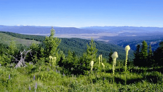
    Blackfoot River Valley, Montana | Photo: BLM/Montana

    Widespread environmental influences, such as invasive species, wildfire, and development, affect ecoregions that are managed, in part, by the BLM. In response, the BLM launched 14 rapid ecoregional assessments (REAs) since 2010 to improve the understanding of the existing condition of these ecoregions and how conditions may be altered by ongoing environmental changes and land use demands.

    REAs do not allocate resource uses or make management decisions. They provide science-based information and tools for land managers and stakeholders to consider in subsequent resource planning and decisionmaking processes. REAs examine ecological values, conditions, and trends within large, connected areas that have similar environmental characteristics in order to capitalize on efficiency of scale. REAs provide context in support of the site-specific data and knowledge required to make site-specific decisions and conduct analyses for resource management plans and National Environmental Policy Act processes.


    Benefits of REAs

    REAs look across an ecoregion to help the BLM more fully understand ecological conditions and trends, natural and human influences, and opportunities for resource conservation, restoration, and development. Through REAs, the BLM seeks to identify important resource values and patterns of environmental change that may not be evident when managing smaller, local land areas. The REAs provide regional information that inform and benefit local management efforts.

    REAs describe and map conservation elements, which are areas of high ecological value. REAs look across all lands in an ecoregion to identify regionally important habitats for fish, wildlife, and species of concern. REAs then gauge the potential of these habitats to be affected by four overarching environmental change agents: climate change, wildfires, invasive species, and development (both energy development and urban growth). Additional change agents may also be addressed based on ecoregional needs.

    REAs also help identify areas that do not provide essential habitat, areas that are not ecologically intact or readily restorable, and areas where development activities may be directed to minimize impacts to important ecosystem values.

    In addition, REAs establish baseline ecological data to gauge the effect and effectiveness of future management actions. In this way, REAs provide a foundation for an adaptive management approach that enables implementation strategies to adjust to new information and changing conditions.

    In summary, REAs:

    • Identify and answer important management questions.
    • Document key resource values, which are referred to as conservation elements, with a focus on regionally significant terrestrial habitats, aquatic habitats, and species of concern.
    • Describe influences from four environmental change agents: climate change, wildfire, invasive species, and development.
    • Assess the collective effects of projected trends.
    • Identify and map key opportunities for resource conservation, restoration, and development.
    • Identify science gaps and data needs.
    • Provide a baseline to evaluate and guide future management actions.


    The Application of REAs

    The BLM uses REAs to inform resource management at the ecoregional and local levels. At the ecoregional level, along with input from stakeholders, partner agencies, and tribes, the REAs aid in developing broad-level management strategies for an ecoregion’s public lands. This ecoregional direction identifies priority areas for conservation and development, including key areas for conserving wildlife habitats and migration corridors and key areas for potential energy development and urban growth. Ecoregional direction also provides a blueprint for coordinating and implementing these priorities through the BLM’s state and field offices.

    At the local level, REAs enhance the quality of land use planning and environmental analysis conducted by BLM field offices. The information, maps, and tools provided by the REAs strengthen analyses of the potential and cumulative effects of climate change and other environmental disturbances on important ecological values.

    In addition, REAs present an opportunity for all land managers within an ecoregion to share information and discuss resource management conditions and needs. REAs provide a science-based information platform for formulating coordinated, multiagency strategies that can respond effectively to environmental challenges that transcend local administrative boundaries.


    REA Preparation

    REAs begin as a list of management questions from an ecoregion’s resource managers. The questions identify management issues or concerns that cannot be resolved by individual offices alone and have regional importance. For example, management questions for sage-grouse, a wildlife species of concern in several ecoregions, could include:

    • What is the current distribution of occupied habitat and movement corridors for sage-grouse within this ecoregion?
    • What change agents are affecting this habitat and movement corridors?
    • Where are sage-grouse populations at risk?
    • Where are potential habitat restoration areas?

    An REA is designed to answer these and similar management questions regarding an ecoregion’s key resource values and change agents.

    REAs are prepared in two phases. The first phase is the preassessment, which refines the management questions and identifies the data available for analysis. The second phase is the assessment, which conducts the analysis and prepares the assessment report, maps, and supporting documents.

    The phases of the REA are organized into the following seven tasks:

    PhaseTask #Product
    Preassessment1Refine management questions
    2Identify and recommend datasets for analysis
    3Identify and recommend analytical models and tools
    4Prepare REA work plan
    Assessment5Synthesize datasets
    6Conduct analysis and generate findings
    7Prepare REA report, maps, and supporting documents

    An assessment management team composed of federal and state managers and technical specialists from within the ecoregion oversees each REA. The assessment management team guides the assessment and oversees the work of the contractors who perform the technical data management and analysis tasks required by the REA. The BLM hires contractors with special expertise in natural resource assessment and conservation planning.


    Access

    The need for 15 REAs and 2 landscape assessments (similar to REAs), were identified for the Western United States and Alaska. Thirteen of these have been completed; the others are in progress. REA memos and documents are available on the Assessments page. Data products, such as maps, are available on the BLM’s Explore REA Data.


    FIND OUT MORE

    Assessments »

    Landscape Assessments »

    Using REAs »

    Q&A »

    Explore REA Data »

  • Recreation

    ** Under Construction **

    Prized by visitors for their relative open and accessible nature, community-based destinations, and rugged and remote qualities, BLM-managed lands offer unique recreation opportunities compared to the nation’s other public lands such as national parks and national forests. The recreational experiences on BLM public lands are distinguished by the natural, geological, and cultural resources the agency manages and the relative freedom people enjoy shaping their own experiences. In turn, these experiences provide a sense of discovery, wonder, and enjoyment to the public.

    NOTE: Materials available from these pages are contributed by BLM staff. The collections are being developed and may be an incomplete baseline of relevant content. It is expected that each collection will continue growing in time to reflect the most current information available. 

  • Renewable Energy

    NOTE: Materials available from these pages are contributed by BLM staff. The collections are being developed and may be an incomplete baseline of relevant content. It is expected that each collection will continue growing in time to reflect the most current information available. 

  • Sage-grouse

    The Greater sage-grouse inhabits some 150 million acres of sagebrush-steppe lands in western North America and may be best known for the distinctive mating ritual it performs on flat, open patches of the sagebrush sea. More densely vegetated parts of the ecosystem are crucial for later portions of the birds' lifecycle, carried on alongside more than 350 other species that inhabit the biome. These same lands also sustain Western rural economies built on outdoor recreation, ranching, farming, energy development and small businesses. For decades, federal, state and private land managers have worked to conserve and restore the sagebrush ecosystem, with federal agencies managing habitat on the lands whose surface they administer and states managing and monitoring wildlife populations.

    NOTE: Materials available from these pages are contributed by BLM staff. Expect the collection to continue growing in time to reflect the most current information available.

    HABITAT ASSESSMENT FRAMEWORK (HAF)

  • Socioeconomics

    The Socioeconomics Program integrates the disciplines of cultural anthropology, human geography, sociology and economics to support the Bureau′s resource management planning process. 

    NOTE: Materials available from these pages are contributed by BLM staff. The collections are being developed and may be an incomplete baseline of relevant content. It is expected that each collection will continue growing in time to reflect the most current information available.


    Program Links:

  • Soil

    NOTE: Materials available from these pages are contributed by BLM staff. The collections are being developed and may be an incomplete baseline of relevant content. It is expected that each collection will continue growing in time to reflect the most current information available. 

  • Solid Minerals

    Solid minerals include coal and non-energy leasable minerals, hardrock minerals on acquired lands, locatable minerals, and salable minerals. 

    NOTE: Materials available from these pages are contributed by BLM staff. The collections are being developed and may be an incomplete baseline of relevant content. It is expected that each collection will continue growing in time to reflect the most current information available. 

  • Threatened & Endangered Species

    The BLM’s Threatened and Endangered Species Program works to conserve and recover federally-listed animal and plant species and their habitats on public lands.  The program also shares cooperative responsibility with other BLM programs and partners for conservation of species proposed for listing and designated Bureau sensitive species with a goal of avoiding the need to list them in the future. The BLM manages habitat for over 300 wildlife, fish, and plant species listed as threatened or endangered under the Endangered Species Act (ESA) and 12 species identified as candidates for listing.  BLM-managed public lands offer the best opportunity for recovery of many rare or listed plant and animal species because their unique requirements for survival may only occur on federal lands.

    NOTE: Materials available from these pages are contributed by BLM staff. Expect the collection to continue growing in time to reflect the most current information available. 

  • Tribal Relations

    ** Under Construction **

    It is the policy of the Department of the Interior to recognize and fulfill its legal obligations to identify, protect, and conserve the trust resources of federally recognized Indian tribes and tribal members, and to consult with tribes on a government-to-government basis whenever plans or actions affect tribal trust resources, trust assets, or tribal health and safety (512 DM 2: Departmental Responsibilities for Indian Trust Resources).

    This page will be updated as schedules and staff time permits. Please also see the SharePoint Site for the HQ400 Directorate: National Conservation Lands and Community Partnerships for resources.

    NOTE: Materials available from these pages are contributed by BLM staff. The collections are being developed and may be an incomplete baseline of relevant content. It is expected that each collection will continue growing in time to reflect the most current information available. 

  • Vegetation Management

    NOTE: Materials available from these pages are contributed by BLM staff. The collections are being developed and may be an incomplete baseline of relevant content. It is expected that each collection will continue growing in time to reflect the most current information available. 

  • Weeds

    NOTE: Materials available from these pages are contributed by BLM staff. The collections are being developed and may be an incomplete baseline of relevant content. It is expected that each collection will continue growing in time to reflect the most current information available. 

  • Wild and Scenic Rivers

    ** Under Construction **

    The BLM has the responsibility of managing 81 Wild and Scenic Rivers (WSR) in seven states, including about 2,700 river miles and more than 1 million acres (19 percent of the national WSR system). In addition to the 81 designated rivers, the BLM manages hundreds of eligible and suitable WSRs across the country. The BLM’s National Conservation Lands provide national-level management and policy guidance for these rivers and represent the agency on the Interagency Wild and Scenic Rivers Coordinating Council.

    Find commonly used forms, policy, files, and documents by visiting the National Program Coordination directory. Links to national SharePoint pages, commonly used web portals, and WSR resources are located below. Visit the active directory listing to the right to find contact information for state and national leads.

    NOTE: Materials available from these pages are contributed by BLM staff. The collections are being developed and may be an incomplete baseline of relevant content. It is expected that each collection will continue growing in time to reflect the most current information available. 

  • Wild Horses & Burros

    Wild horses and burros are charismatic and federally protected animals in many BLM-managed western rangelands. An extensive body of scientific papers and reports addresses these species. A 2013 National Academies of Sciences report summarized what was known at the time about topics including population size estimation and population dynamics, fertility control, genetics, and human dimensions. A 2019 interagency report examined ecological effects that overpopulated WHB can cause. There are more recent peer-reviewed publications in all those areas. The BLM WHB 2021 Strategic Research Plan summarized many WHB-related studies since 2005. The 2021 plan highlights research topics that would most benefit the BLM’s WHB management in the immediate future.

    There are several ‘sub-pages’ for the WHB SPP page that you can access from the main drop-down list at left. So far, these are limited to the topics that come up the most in NEPA analyses. Subpages include links to current standard operating procedures, updated literature reviews for information and use in NEPA, and some key scientific citations.

    All WHB-related research projects that would rely on BLM personnel, take place on BLM lands, use BLM-managed animals, or be BLM funded must be reviewed by the WHB research advisory team and approved by the WHB Program division chief. Information about WHB research for the public, and for researchers who want to submit WHB-related research proposals is at the BLM WHB program science and research web page, and in the sub-page called BLM-supported WHB Research.

    BLM Contact: Paul Griffin, HQ-261 wild horse and burro research coordinator. Paul helps field, district, and state offices with information about WHB science, especially population growth suppression methods and genetics. He maintains a library of WHB-related papers, and can likely send you copies for internal BLM use.

    The SPP page for the BLM Wild Horse and Burro program is organized by content, with eight sub-pages

    FERTILITY CONTROL

    This subpage has three tabs: 1) Literature review about fertility control methods and sex ratio manipulation, suitable for NEPA; 2) Fertility control standard operating procedures (SOPs); and 3) Key citations for several of the most common fertility control methods. 

    ESTIMATING HERD SIZE AND POPULATION MODELING

    This subpage has two tabs: 1) Estimating herd sizes; and 2) Population modeling. Each tab has links to methods and citations.

    ECOLOGY, ENVIRONMENT, AND CLIMATE CHANGE

    This subpage has three tabs: 1) Literature review suitable for NEPA; 2) Key papers on WHB  ecological effects; and 3) Assessment, Inventory, and Monitoring (AIM) and the WHB program

    GENETICS

    This subpage has three tabs: 1) A discussion about metapopulations; 2) Key citations on genetics; and 3) Past genetic monitoring reports for a number of HMAs.  

    HEALTH, HANDLING, AND WELFARE

    This subpage includes key citations, and a literature review on the expected effects of gathers, handling, and removal that is suitable for NEPA.

    PRIVATE CARE PLACEMENT

    This subpage refers to a couple key research papers about WHB private care placement. 

    HUMAN DIMENSIONS OF WHB MANAGEMENT

    This subpage refers to a couple key research papers about human dimensions of WHB management. 

    BLM-SUPPORTED WHB RESEARCH

    This subpage has three tabs: 1) Explanation and templates for how researchers should prepare new research proposals to the BLM; 2) List of recently completed, BLM-approved WHB research and some of the associated research results; and 3) a listing of ongoing, BLM-approved WHB research projects.


    If you have WHB-related material to submit to the SPP, please give it a title that starts with "WHB_" then the first author's last name, year of publication, and brief description, to allow for easier searching. 

  • Wilderness Areas & Wilderness Study Areas

    ** Under Construction **

    The Bureau of Land Management is responsible for 263 wilderness areas and 487 wilderness study areas in the western States and Alaska. From primitive hunting locations to remote fishing spots and extensive hiking, Wilderness and Wilderness Study Areas provide unparalleled opportunities for spending time outdoors. In addition, Lands with Wilderness Characteristics (LWC) are also identified.  Policy guidance (manuals, boundary identification guidance, instruction memorandums, etc.) as well as case law, statistics, current research projects and training materials are available. Training is available on Congressionally-designated Wilderness Areas through the Arthur Carhart National Wilderness Training Center; for Wilderness Study Areas management through the Indiana University--Eppley Center for Parks and Public Lands (access via DOI Talent), or , and for Lands with Wilderness Characteristics through the BLM Wilderness SharePoint site.

    Scientific research in BLM wilderness should be reviewed using the Minimum Requirements Analysis Framework (MRAF) prior to authorizing the activity, whether the research is conducted by BLM staff or by another Federal or non-Federal entity. The MRAF is the primary tool used to conduct the Minimum Requirements Analysis (MRA).  The MRAF is intended to help managers: 1) evaluate actions proposed in wilderness involving a use otherwise prohibited by the Wilderness Act; and 2) consider appropriate choices about administrative actions they might take. 

    Scientific research in BLM wilderness should be permitted, using the Recreation and Permit Tracking Online Reporting (RAPTOR) system whenever appropriate.

    NOTE: Materials available from these pages are contributed by BLM staff. The collections are being developed and may be an incomplete baseline of relevant content. It is expected that each collection will continue growing in time to reflect the most current information available. 

  • Wildlife

    The BLM’s Wildlife Program manages wildlife habitat to help ensure self-sustaining, abundant and diverse populations of wildlife on public lands. In order to provide for the long-term conservation of wildlife resources, the BLM supports numerous habitat maintenance and restoration activities. BLM-managed lands are vital to thousands of mammal, reptile, avian, and amphibian species. Managing more wildlife habitat than any other federal agency, the BLM’s wildlife program helps ensure self-sustaining populations and a natural abundance and diversity of wildlife on public lands. Overall, we manage habitat for more than 3,000 species of wildlife dispersed over some of the nation’s most ecologically diverse and unique habitats. In order to provide for the long-term protection of wildlife resources, the BLM supports numerous habitat conservation activities, many funded through partnerships with federal, state, and nongovernmental organizations.

    NOTE: Materials available from these pages are contributed by BLM staff. Expect the collection to continue growing in time to reflect the most current information available.