Sagebrush-Steppe Ecosystems - the following pages will guide biologists to scientific information housed in a variety of locations (ex. BLM Library, SharePoint sites, or other resources). Please contact the HQ231 Sage-Grouse Program Lead (Pat Deibert) for recommendations on improving the site or additional links.
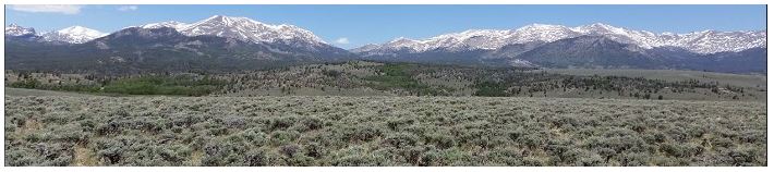
Sagebrush
The sagebrush ecosystem encompasses more than 175 million acres across the western United States, and supports more than 350 species of plants, invertebrates, and vertebrates, including multiple BLM sensitive species. Sagebrush ecosystem integrity is negatively impacted from multiple threats, including wildfire, particularly as exacerbated by invasive annual grasses, climate change, human development and conifer expansion. Approximately 1.3 million acres of sagebrush habitats are lost or degraded annually from these and other factors.
The BLM manages the majority of sagebrush habitat and is collaborating with multiple partners to maintain the health of the entire ecosystem, ensuring wildlife and plant conservation, and supporting multiple economies based in this diverse system. Approximately half of the range of the greater sage-grouse (67 million of 150 million acres) is managed by the BLM. Intense interest in greater sage-grouse, including multiple reviews by the U.S. Fish and Wildlife Service for potential listing under the Endangered Species Act, has prompted the BLM to ensure land use plans are consistent with conservation of this iconic species. Currently, the BLM is revising plan amendments to incorporate the most recent scientific information on this bird and associated sagebrush habitats, and in response to court direction. Additionally, the BLM is revising land use plans in CO and UT to ensure the conservation of Gunnison sage-grouse, a threatened species with limited distribution in those states.
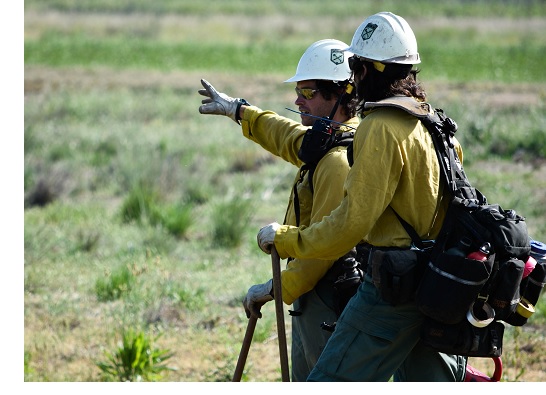 Since wildfire is a major threat to sagebrush habitats, particularly in the Great Basin states, BLM grouse biologists coordinate closely with BLM fuels staff to identify opportunities for pro-active fire prevention, and sagebrush habitat restoration post-fire. This effort is captured through the Integrated Program of Work (VPN is required). Details on how IPOW is implemented through the budget process can be found in BIO 101 training, detailed in the policy and training tab.
Detailed information on the sagebrush ecosystem and threats challenging conservation can be found in the WAFWA Sagebrush Conservation Strategy, Part I, Challenges to Sagebrush Conservation. This 2021 document provides an overview and assessment of challenges facing land managers and landowners in conserving sagebrush ecosystems. The Sagebrush Conservation Design tool provides a map of the sagebrush ecosystem that identifies ecological integrity based on measures of human activity, invasive annual grasses, and conifer encroachment. This model can be used to help identify areas to focus conservation efforts at a landscape scale. Additional on the ground review will assist in accurately identifying what conservation efforts will be necessary depending on project objectives. The NRCS Working Lands for Wildlife has created a conservation framework for sagebrush focused on rangeland management and the interplay of public and private lands.
Two key publications address invasive species management in sagebrush ecosystem. These documents were produced by the Western Association of Fish and Wildlife Agencies (WAFWA) but were drafted through interagency coordination. The Western Weed Action Plan is a multi-agency action plan to address invasive plant species in the western United States. A “gap” report – identifying where actions for managing invasive plants in sage-grouse habitats are needed (official title: Invasive Plant Management and Greater Sage-grouse Conservation) was published in 2018. This report identifies opportunities and challenges for all levels of participation in addressing invasive vegetative species.
Additional databases are helpful in identifying areas of pro-active conservation or restoration, including cheatgrass distribution, rangeland analyses combining satellite imagery with on the ground vegetation measurements. There are multiple other databases and spatial tools available for use depending on the specific objectives of your conservation effort.
Inventory and Monitoring
Measuring the impacts of our management activities is critical for adaptive management. Therefore, it is necessary to develop and implement ways to monitor and assess habitats. The following information will assist BLM biologists in identifying proper inventory and monitoring techniques.
The BLM’s Assessment, Inventory and Monitoring Strategy (AIM) provides standardized monitoring strategy for assessing natural resource condition and trend on BLM lands. This tool is for all BLM lands, including aquatic habitats, but due to the amount of sagebrush managed by BLM a majority of these efforts outside of Alaska occur in that ecosystem. AIM outlines standardized field measurements, sample designs, data management and stewardship, analysis frameworks for data use, and integration with remote sensing tools.
 The Sage-grouse Habitat Assessment Framework (HAF) is a multi-scale sage-grouse habitat assessment tool that establishes indicators to determine the status of sage-grouse habitats. Development of this assessment tool was closely coordinated with AIM to ensure the data required for HAF was consistent with that effort. In short, HAF focuses on sage-grouse habitats, but the data collected can be used in AIM assessments, reducing duplicative sampling efforts.
BLM compiled a Rangewide Monitoring report for Greater sage-grouse plan implementation (2015-2020 Monitoring Report). The report summarizes data collected through a monitoring framework identified in the 2015 land use plan amendments for greater sage-grouse. Two scales were examined – rangewide and land use plans. For the rangewide scale data were collated on sage-grouse habitat availability, condition and degradation, intensity of development in habitat management areas, and sage-grouse population size. At the land use plan scale data assembled reflects implementation of the land use plan habitat and disturbance objectives, measures of land health standards, and trend of greater sage-grouse populations in the planning area.
Sage-grouse Bibliography - there is so much information to be discovered regarding sage-grouse. Use the following bibliography to get you started down the right path for your investigations.

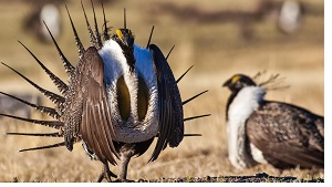 Greater sage-grouse (Centrocercus urophasianus) have been petitioned 7 times for listing under the Endangered Species Act throughout all or portions of its range. In 2010 the Secretary of the Interior requested the U.S. Fish and Wildlife Service identify what factors need to be addressed to preclude the need to list the greater sage-grouse. The resulting document – the Conservation Objectives Team Report was a collaborative effort between U.S. Fish and Wildlife Service and all state wildlife management agencies within the species range, with the exception of South Dakota. Our understanding of threats to greater sage-grouse has continued to expand, but the COT Report remains a valuable resource and is frequently cited by many parties when discussing threats to the species.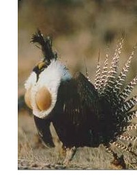
 It's Sage-grouse... things are emerging ALL the time!!!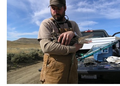
 USGS annual summary publications provide abstracts and links to publications and data for their research on sage-grouse and sagebrush. Much of this research is funded and conducted in collaboration with BLM.
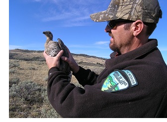 The science within the SPP science relies on YOU, the field biologist. As professional managers of wildlife you will often develop or follow science-based protocols based on studies conducted in your area. These scientific reports are extremely beneficial to you and other biologists throughout the agency. To best assists fellow and future BLM biologists, it is imperative you upload science-based documents related to research conducted in your area.
 As great as it would be to have EVERYTHING uploaded, we also need to make sure the SPP does not get overloaded with information that may not be useful.