
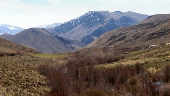
The Middle Rockies REA was initiated in September 2010. It has been completed and peer reviewed and is now available to the public. The Memos and Reports section provides access to the REA data for this ecoregion.
The Middle Rockies ecoregion is located in Montana, Idaho, Wyoming, and also includes a disconnected portion of South Dakota. The ecoregion has an area of 63,400 square miles, including 3.9 million acres of public lands. The ecoregion includes all or portions of 20 BLM field offices.

The management questions for the Middle Rockies REA were finalized in January 2011 in the Middle Rockies Task 1 Final Memorandum. They seek information related to:
-
Terrestrial biotic resources
-
Aquatic/Riparian Biotic Resources
-
Landscape Species/Species Richness
-
Change Agents
-
Invasive or Undesired Non-native Species, Insect, and Disease
-
Urban, Agricultural, Industrial, and Water Development
-
Climate Change
Conservation elements are resources of conservation concern within an ecoregion. This REA will assess the current status and forecast the future condition of these conservation elements:
-
"Coarse-filter" ecological systems, which represent characteristic vegetation assemblages occurring within the ecoregion;
-
"Fine-filter" plant species conservation elements, which represent a dominant plant species characteristic of each of the four largest geographical ecological system coarse-filters in the Middle Rockies Ecoregion;
-
Landscape-species conservation elements, in which selected species represent a range of important attributes characterizing the environment in which they occur.
A full list and description of conservation elements can be found in the Phase 1 Task 1 Memo.
Change agents are disturbances on the landscape that can influence ecosystem health. They can have natural causes, such as wildfire; human causes, such as energy development; or result from the interaction of both, such as climate change. A key purpose of this REA is to understand the influences of significant, widespread change agents on the natural resources (represented by the conservation elements discussed above) of the Middle Rockies.
This REA will examine the potential effects of the following change agents. A more complete discussion of change agents is presented in the Task 1 Final Memorandum.
Change Agents to Be Addressed in the Middle Rockies REA:
-
Wildland Fire
-
Invasive Species: terrestrial and aquatic
-
Land and Resource Uses:
-
Urban and Roads Development
-
Energy Development and Mining
-
Agriculture
-
Hydrological
-
Recreation
-
-
Climate Change
-
Insect Outbreak and Diseases
Geospatial data, maps, and models used in and produced by the REAs will be made available to the public upon final completion of each individual assessment. In some instances, data may be released in phases for an REA to expedite public access to particular data sets. To learn more about REA data products and determine which REAs have available data, go to the REA Data Portal.
For each REA, there is a series of memos which are supplemental documents to the final report. Memos document the major tasks and decision points made during the assessments and provide pertinent background information necessary to understand the justification and methods used during the assessment. As memos and the final report are completed, they can be downloaded through the table below.
Middle Rockies (MIR) REA Memos and Reports
| Description | Document Link |
|---|---|
Management questions, conservation elements, and change agents |
Task 1 Final Memorandum |
Datasets for analysis |
Task 2 Final Memorandum |
Analytical models and tools |
Task 3 Final Memorandum |
REA final report is in multiple PDF files Refer to the Table of Contents in Section 1 for Data, maps, and models available through the Data Portal. |
MIR Final Report & Appendices A & B (Mgmt Questions & Gap Analysis) MIR Appendix C (Climate Change) MIR Appendix C (Description & Analysis) MIR Appendix C (Invasive species) MIR Appendix D (Coarse Filter) MIR Appendix E (1-4 Fine Filter, various) MIR Appendix E (5-8 Fine Filter, various) MIR Appendix F & G (Data Quality Evaluation, Figures) MIR Appendix H (Climate Change Vulnerability) MIR Forest Mortality Report Final |