
The Northern Great Basin REA was initiated in September 2011. It has been completed and peer reviewed and is now available to the public. The Memos and Reports section provides access to the REA data for this ecoregion.
The Northern Great Basin (NGB) REA consists of both the Northern Basin and Range and the Snake River Plain ecoregions and is located primarily in Idaho, Utah, Nevada, California, and Oregon. These ecoregions have an area of approximately 75,000 miles². The REA covers all or parts of 24 BLM Field Office administrative areas.
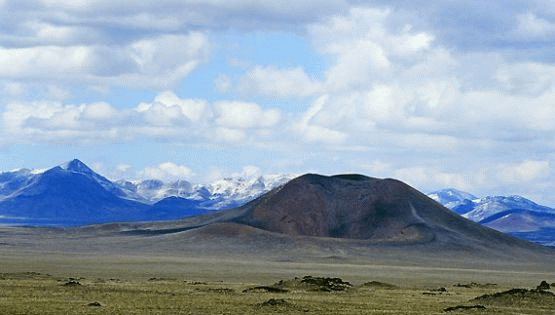
It is the northern extent of the larger Basin and Range physiographic province, and is characterized by high arid basins alternating with isolated fault block mountains including Steens Mountain and Hart Mountain. Repeated glaciations and stream erosion have carved dramatic valleys in these mountains and in the Owyhee High Plateau.
Most of the ecoregion is dominated by sagebrush steppe ecosystems on the desert floor, but distinct vegetation zones related to relief and elevation also exist. The desert floor is characterized by big sagebrush (Artemisia tridentata), low sagebrush (Artemisia arbuscula)-and salt-desert shrub systems. With increasing elevation, the higher plateaus and rocky areas support western juniper (Juniperus occidentalis) and curlleaf mountain mahogany (Cercocarpus ledifolius) communities. Aspen (Populus tremuloides) communities grow along streams and drainages in the mountain gorges and riparian zones, providing an important source of forage for deer and other wildlife. Isolated stands of Douglas-fir (Pseudotsuga menziesii) and whitebark pine (Pinus albicaulis) also occur in the mountains. The subalpine zone supports low-growing shrubs, grasses, and wildflowers such as mountain meadow knotweed (Polygonum bistortoides) and false hellebore (Veratrum viride).
Terrestrial wildlife species of concern include bighorn sheep (Ovis canadensis), mule deer (Odocoileus hemionus), elk (Cervus elaphus), pronghorn (Antilocapra americana), pygmy rabbit (Brachylagus idahoensis), snowshoe hare (Lepus americanus), golden eagle (Aquila chrysaetos), and greater sage-grouse (Centrocercus urophasianus). Important habitats in the ecoregion include migration corridors and areas for overwintering pronghorn, as well as seasonal habitats for greater sage-grouse. The Northern Basin and Range ecoregion also supports thousands of migratory waterfowl in the Malheur Lake area, and populations of the Lahontan cutthroat trout (Oncorhynchus clarkii henshawi), redband trout (Oncorhynchus mykiss), bull trout (Salvelinus confluentus), warm water fish, bat species, and spotted frog (Rana luteiventris).

The management questions for the NGB were finalized in February 2012 in the NGB Task 1 Final Memorandum. Initially 78 questions, were formulated to guide the REA. They seek information related to:
-
Conservation Elements including, but not limited to: several wildlife species, native plant communties, areas with high biodiversity, specially designated areas, vulnerable soils, wild horses and burros.
-
Change Agents including, but not limited to: climate change, development, fire, recreation, ground and surface water uses, renewable and non-renewable energy, atmospheric deposition and grazing.
These management questions were organized into three tiers, based on the complexity of the question:
-
Tier 1 management questions involve presentation of basic data describing locations of conservation elements or change agents.
-
Tier 2 management questions identify where conflicts may occur between conservation elements and change agents.
-
Tier 3 management questions are the highest level questions, which ask about the significance of the change agent risks or the management implications identified by the Tier 2 questions and answers, or additional spatial analysis.
During the REA process, 12 management questions were eliminated due to lack of available data, or because the assessment management team determined that an answer to the question could not be portrayed spatially.
Conservation elements are resources of conservation concern within an ecoregion. This REA assessed the current status and forecast the future condition of the conservation elements identified by the assessment management team. A full list of the conservation elements and a description of how they were selected is included in section 3.2 of the NGB REA Final Report.
In brief, the coarse-filter conservation elements for the NGB REA include sagebrush, salt desert shrub, juniper species, aspen, streams and rivers, springs and seeps, groundwater, and wetlands. Wild horses and burros and specially designated areas were also treated as coarse-filter conservation elements in the NGB REA because they occur within discrete polygons on the landscape.
Examples of fine-filter conservation elements include mule deer, greater sage grouse, golden eagle, pygmy rabbit, bighorn sheep, and bats. The primary criterion for selecting fine-filter conservation elements was that they should be native species of regional management concern.
Change agents are disturbances on the landscape that can influence ecosystem health and the future status of conservation elements. They can have natural causes, such as wildfire; human causes, such as energy development; or result from the interaction of both, such as climate change. A key purpose of this REA is to understand the influences of significant, widespread change agents on the natural resources (represented by the conservation elements discussed above) of the NGB Ecoregion.
This REA will examine the potential effects of the following change agents. A more complete discussion of change agents is presented in the Task 1 Final Memorandum.
Change Agents to be Addressed in the Northern Great Basin REA:
Wild Fire
Invasive Species
Development:
-
Urban and Road Development
-
Oil, Gas, and Mining Development
-
Renewable Energy Development
-
Agriculture
-
Groundwater Extraction
-
Recreational Use
-
Climate Change
Grazing
Geospatial data, maps, and models used in and produced by the REAs are available to the public upon final completion of each individual assessment. To learn more about REA data products and determine which REAs have available data, go to the REA Data Portal.
For each REA, there is a series of memos which are supplemental documents to the final report. Memos document the major tasks and decision points made during the assessments and provide pertinent background information necessary to understand the justification and methods used during the assessment. As memos and the final report are completed, they can be downloaded through the table below.
Northern Great Basin (NGB) REA Memos and Reports
| Description | Document Link |
|---|---|
Management questions, conservation elements, and change agents |
Task 1 Final Memorandum |
Datasets for analysis |
Task 2 Final Memorandum |
Analytical models and tools |
Task 3 Final Memorandum |
REA work plan |
Task 4 Final Workplan |
REA report, maps, and supporting documents |
NGB Final Main Report & Appendix A (Mgmt Questions) NGB Appendix B1 (Change Agents) NGB Appendix B2 (Fine Filter) NGB Appendix B3 (Coarse Filter) |