
The BLM initiated the Central Basin and Range REA in July 2010. This REA is complete, peer reviewed, and available to the public.
The Central Basin and Range encompasses large areas of Nevada and Utah and extends into California and Idaho. It lies to the immediate east of the Sierra Nevada, to the north of the Mojave Basin and Range, to the west of the Wasatch/Uinta Mountains, and south of the Northern Basin and Range ecoregions. The ecoregion has a total area of 120,000 square miles and includes all or portions of land managed by 16 BLM field offices.
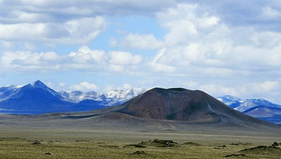
The Central Basin and Range ecoregion is internally drained and is characterized by a mosaic of dry basins, scattered low and high mountains, and salt flats. It has a hotter and drier climate, more shrubland, and more mountain ranges than the Northern Great Basin ecoregion to the north.
Between the Sierra Nevada to the west and Wasatch ranges to the east, more than 300 long, narrow, roughly parallel mountain ranges are separated by broad elongated valleys. Basins are generally covered by Great Basin sagebrush or saltbush-greasewood vegetation. Cool season grasses are less common than in the Snake River Plain and Northern Great Basin ecoregions. The region is not as hot as the Mojave Basin and Range ecoregion to the south, and it has a greater percent of land that is grazed.
Along its western and eastern edges, the ecological boundary of the Central Basin and Range is distinguished by fairly sharp vegetation changes and abrupt transitions into higher elevation environments. The transitions are less abrupt along the southern borders, as cool semidesert transitions into the warm desert of the Mojave Basin and Range. The northern transition into the Northern Great Basin is more subtle, as sagebrush vegetation dominates much of that transition.
Rain shadow effects from the east and west create an arid climate throughout the ecoregion. The Sierra Nevada range effectively captures precipitation traveling east from the Pacific Ocean, while the Rocky Mountains intercept precipitation heading northwest from the Gulf of Mexico. Temperatures vary drastically among high and low elevations. Average winter temperatures are 10 to 40° F, while summer temperatures are typically 50 to 90° F.

The BLM finalized and presented the management questions for the Central Basin and Range REA in August 2010 in the Central Basin and Range Task 1 Final Memorandum. The management questions address specific information needs that guided the REA and inform management actions on the landscape. The BLM formulated and organized approximately 81 questions into 20 categories. Examples of the categories and number of management questions in each category include:
-
Species as conservation elements (9 questions)
-
Terrestrial sites of high biodiversity (3 questions)
-
Aquatic sites of high biodiversity (4 questions
-
Surface and subsurface water availability (6 questions)
-
Climate change: terrestrial resource issues (6 questions)
- Wild horses and burros (7 questions)
Conservation elements are resources of conservation concern within an ecoregion. This REA assessed the current status and forecasted the future condition of two basic types of conservation elements:
-
"Coarse-filter" conservation elements, which are broad vegetation assemblages within the ecoregion.
-
"Fine-filter" conservation elements, which are representative, important, or vulnerable plant and animal species.
A full list and explanation of the conservation elements are in the Phase 1 Task 1 Memo. In brief, the coarse-filter elements include 26 terrestrial and aquatic ecological system types and communities, nested within 4 ecosystem categories, which represent the predominant ecological pattern and dynamics of the ecoregion. The four broad ecosystem categories are basin dryland ecosystems, basin wet ecosystems, montane dryland ecosystems, and montane wet ecosystems.
Change agents are disturbances on the landscape that can influence ecosystem health. They can have natural causes, such as wildfire; human causes, such as energy development; and often result from the synergistic interaction of both, such as climate change. A key purpose of this REA is to understand the influences of significant, widespread change agents on the natural resources (represented by the conservation elements previously discussed) of the Central Basin and Range ecoregion.
This REA examined the potential effects of the following change agents. A more complete discussion of change agents is presented in the Task 1 Final Memorandum.
Change Agents Addressed in the Central Basin and Range REA:
Wildland Fire
Invasive Species
Land and Resource Uses:
-
Urban and Roads Development
-
Oil, Gas, and Mining Development
-
Renewable Energy Development
-
Groundwater and Surface Water Extraction, Development, and Transportation
-
Military Use
-
Livestock Grazing
-
Wild Horse and Burro Grazing
-
Recreational Uses
-
Pollution (Air Quality)
-
Climate Change
Geospatial data, maps, and models used in and produced by the REAs are available in the final report.
Each REA has a series of memos that are supplemental documents to the final report. Memos document the major tasks and decision points made during the assessments and provide pertinent background information necessary to understand the justification and methods used during the assessment. Memos and the final report are available through the table below.
Central Basin and Range (CBR) REA Memos and Reports
| Description | Document Link |
|---|---|
Management questions, conservation elements, and change agents |
Task 1 Final Memorandum |
Datasets for analysis |
Task 2 Final Memorandum |
Analytical models and tools |
Task 3 Final Memorandum |
REA work plan |
Task 4 Final Workplan |
Preliminary findings for review |
Task 5 Final: Day 1A Task 5 Final: Day 1B Task 5 Final: Day 2A Task 5 Final: Day 2B |
REA Final Report Refer to the Table of Contents for detailed descriptions of each Section and Appendix. Data, maps, and models available through the Data Portal. |
CBR Final Report CBR Appendix A (Change Agents) CBR Appendix B (Conservation Elements) CBR Appendix C (Places) CBR Appendix D (Integrated Assessment) CBR Appendix E (References) CBR Appendix F (Case Studies) |